We had a huge day of driving and sightseeing ahead of us in our trip from Belfast to Sligo via the North Coast so we had an early start.
Everywhere you look in Northern Ireland the scenery is breathtaking. The bright blue sky and the emerald green of the fields are only broken up by rough cliffs and sea glimpses. The weather had now turned and the cloudless days, whilst beautiful, were cold.
Our first destination was the Dark Hedges, only an hour outside of Belfast. We should point out that the initial reason we went there was to see the filming location for the Game of Thrones TV series. Regardless of the pop culture reference, it was amazing.
The Dark Hedges is a beautiful avenue of beech trees, planted by the Stuart family in the eighteenth century. Two hundred years later, the Dark Hedges have become one of the most photographed natural phenomena in Northern Ireland.


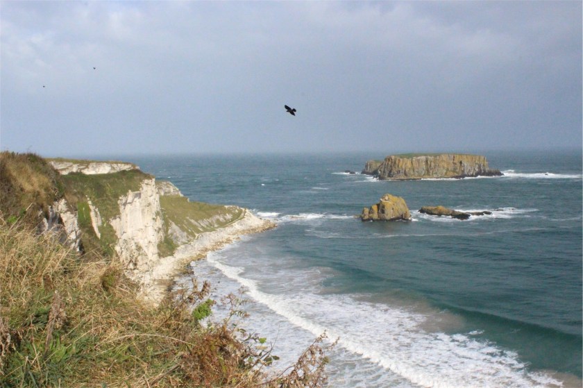
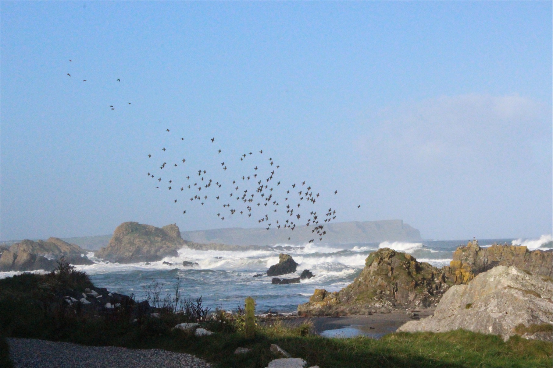
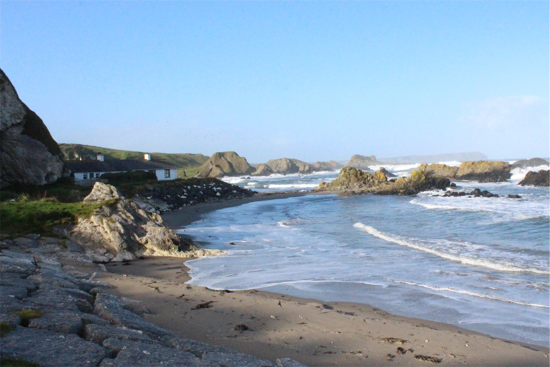
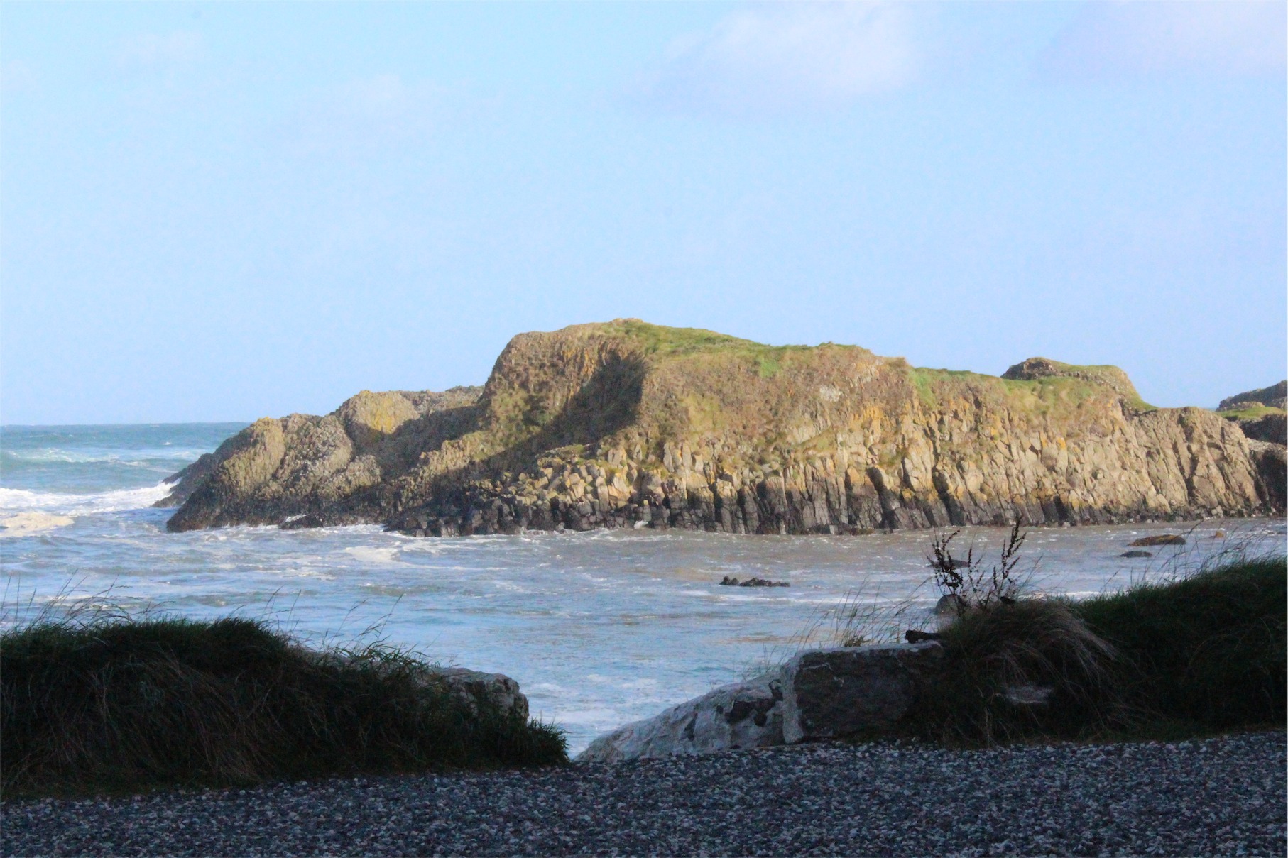
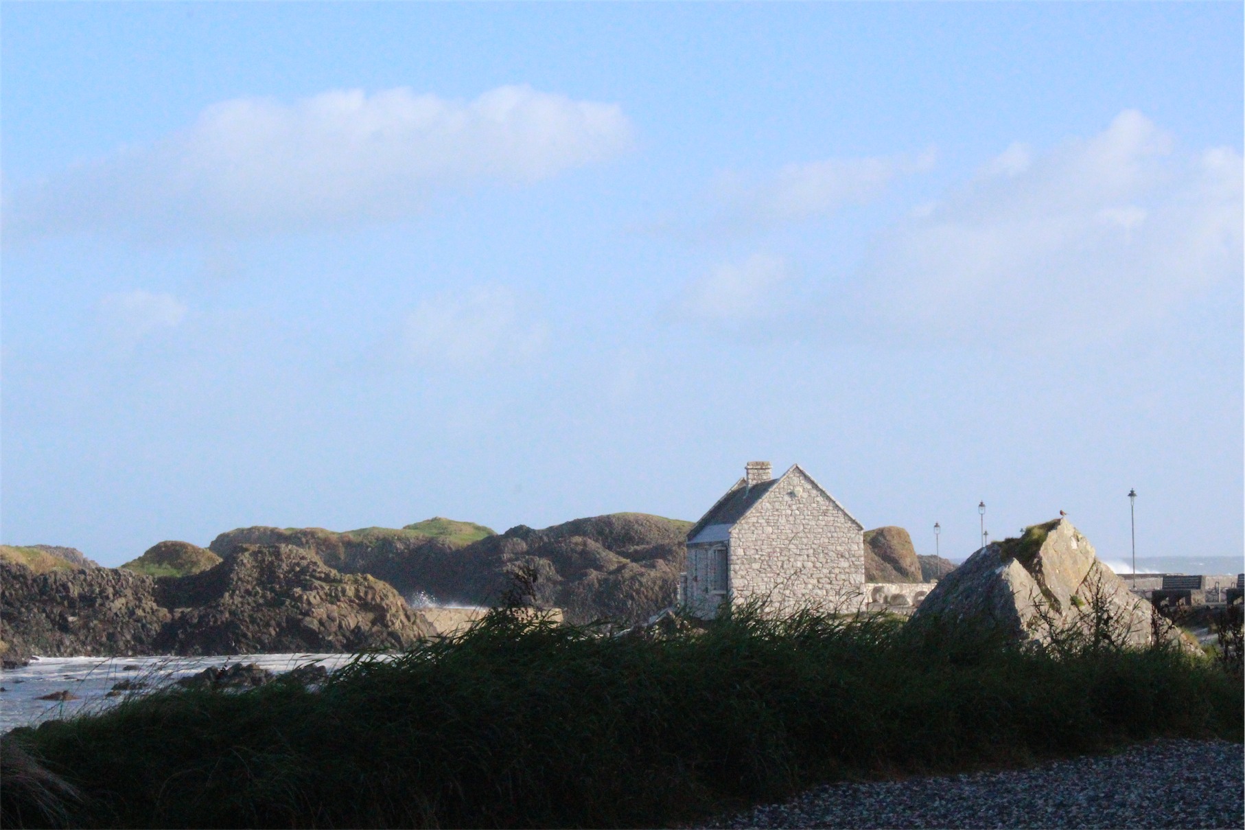
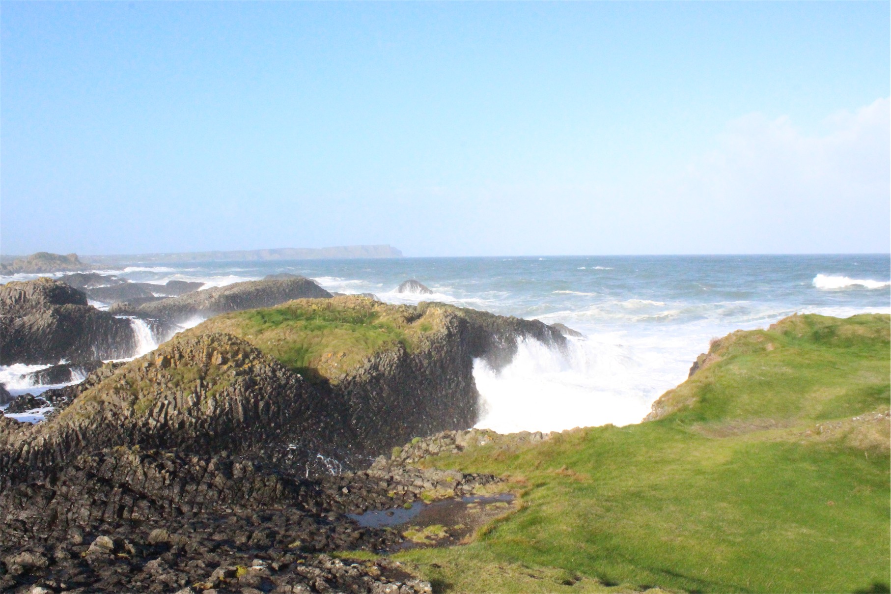
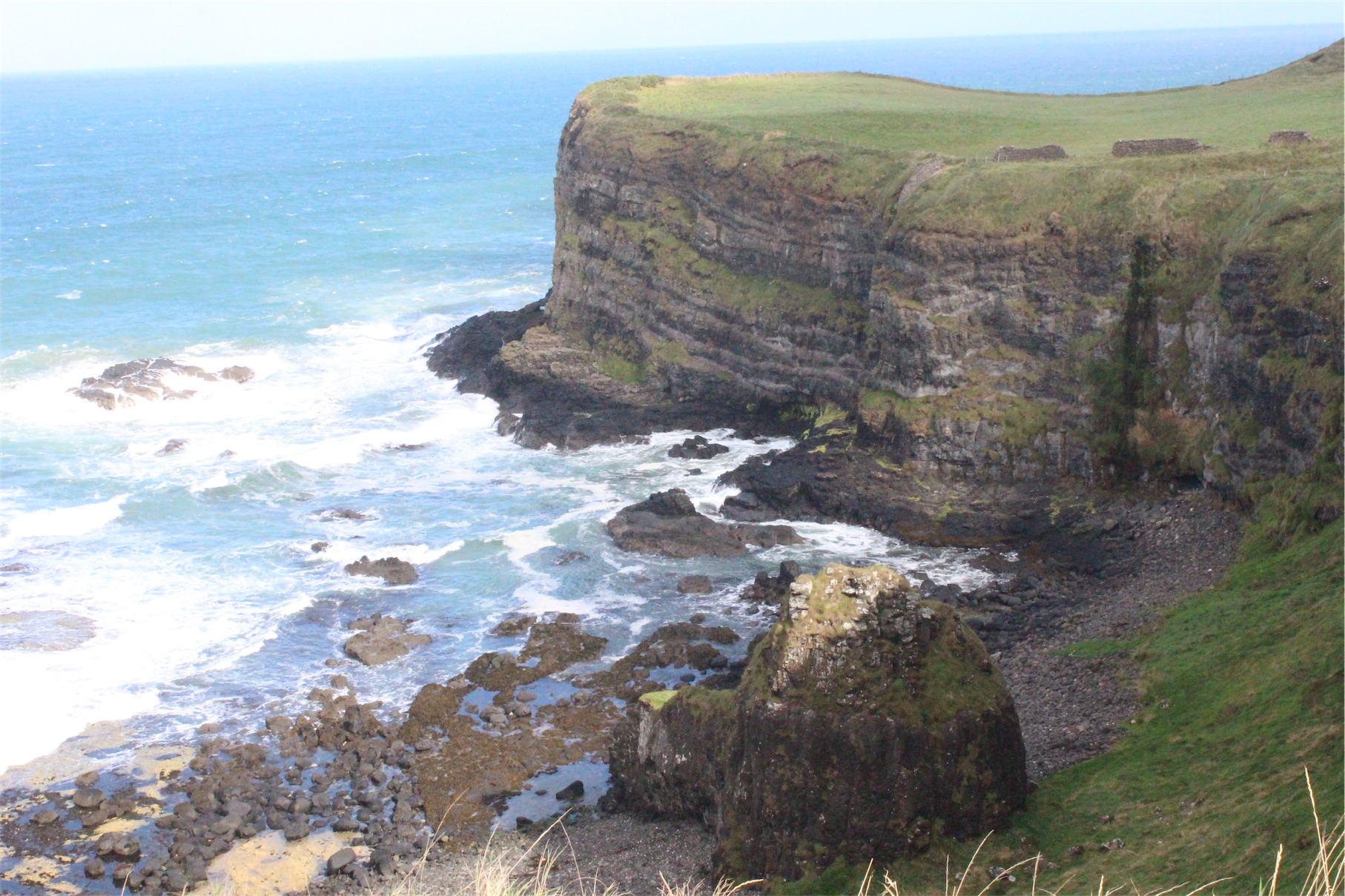
Ballintoy is situated in one of the most picturesque parts of the North Antrim Coast between the Giant’s Causeway and Carrick-a-Rede Rope Bridge. This stunning harbour location has been used for exterior Pyke shots and as the Iron Islands in Game of Thrones.
We spent a lot of time at the harbour exploring the rocky coastline. The noise of the wind, ocean and birds was deafening, particularly as the waves crashed onto the rocky shore. Despite this it was incredibly relaxing and strangely calming.

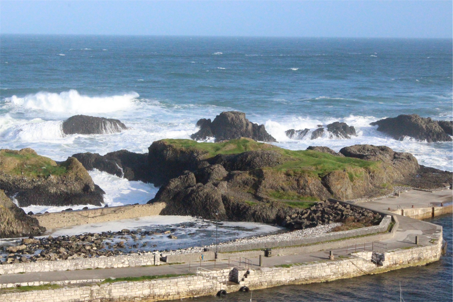


As we continued along the North Antrim Coast we made our way to Larrybane headland. Larrybane was featured in Game of Thrones being the location of Renly Baratheon’s camp site in Season 2.


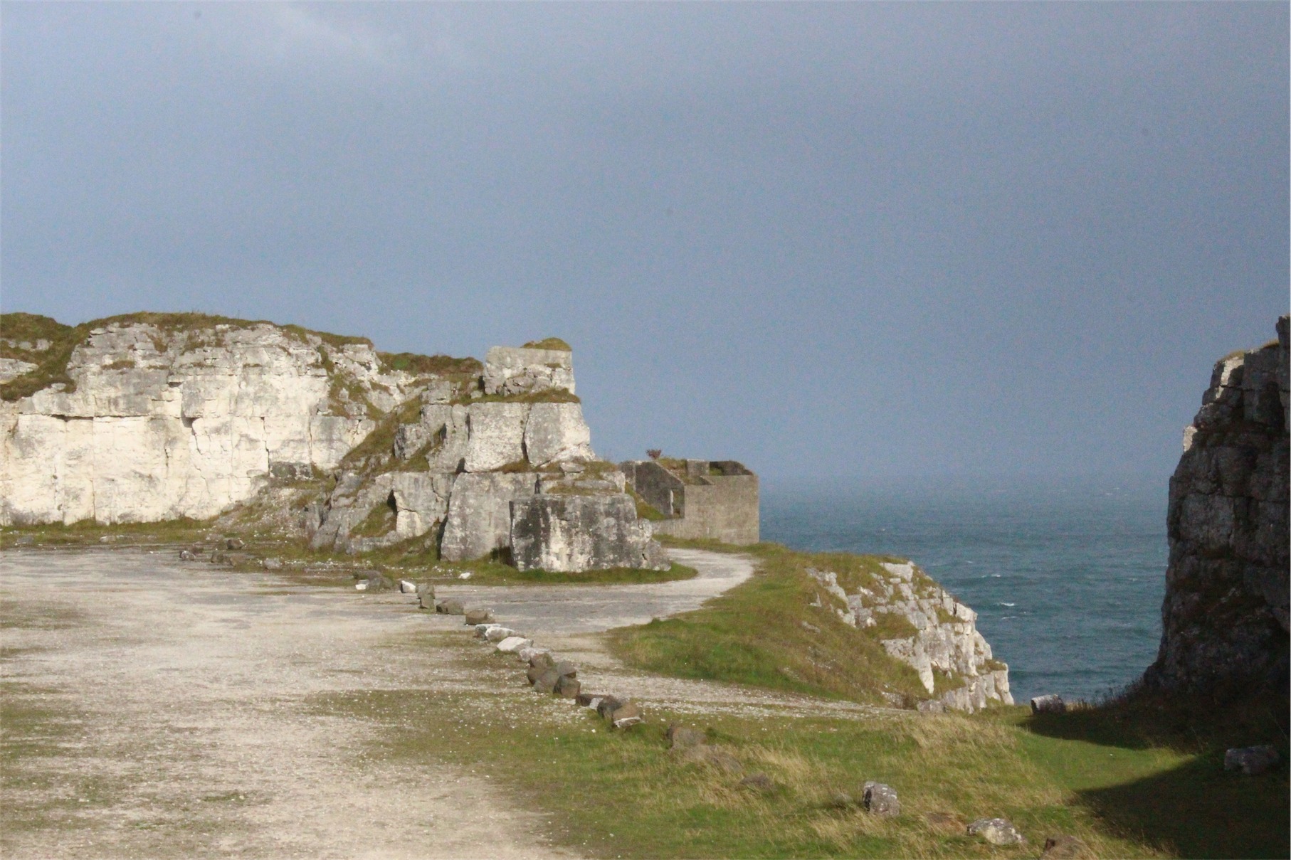
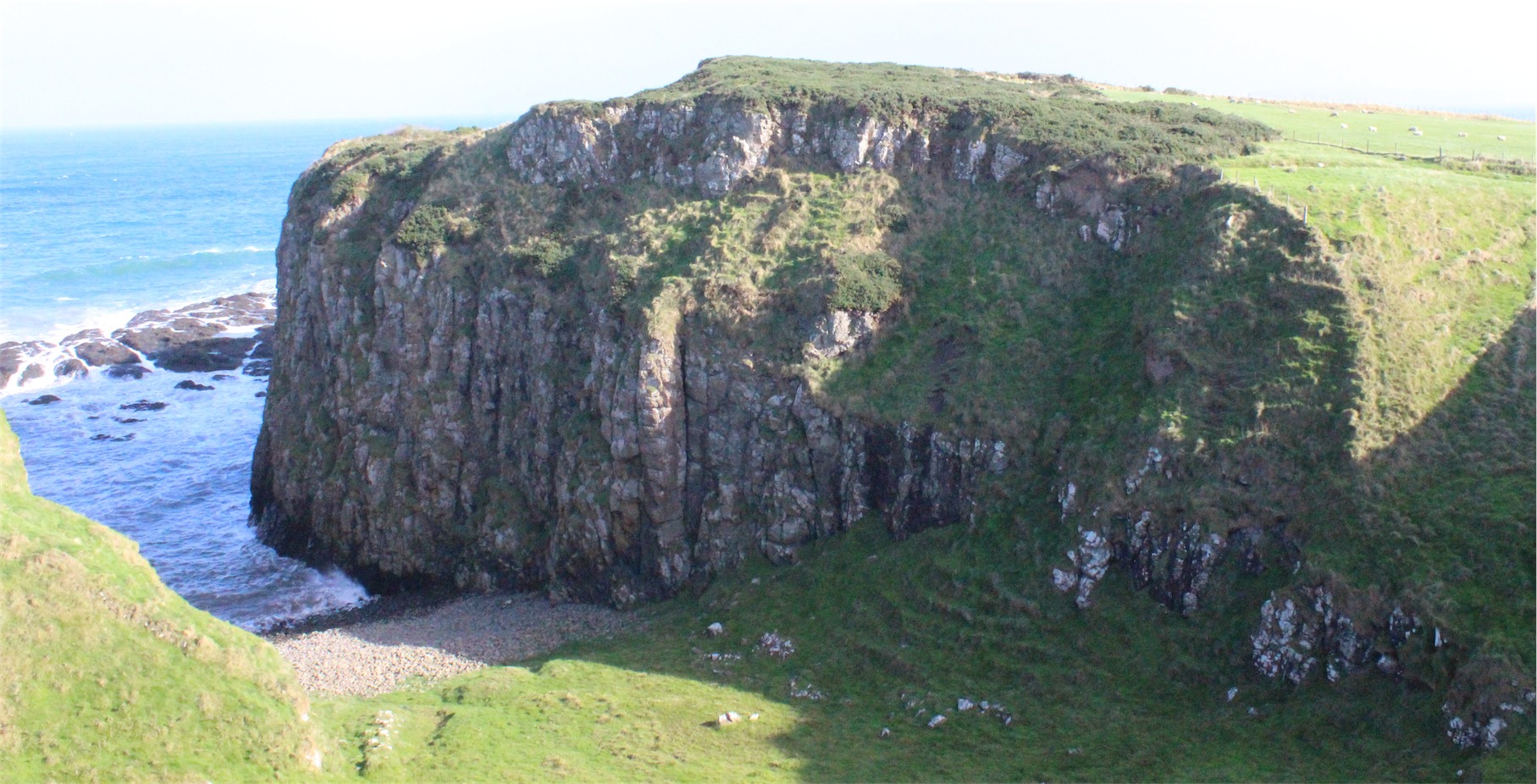
The coastline constantly surprised us with spots like the White Bay viewpoint and Castle Dunseverick. We had to stop a number of times to enjoy the scenery and take photos before reaching the Giant’s Causeway.
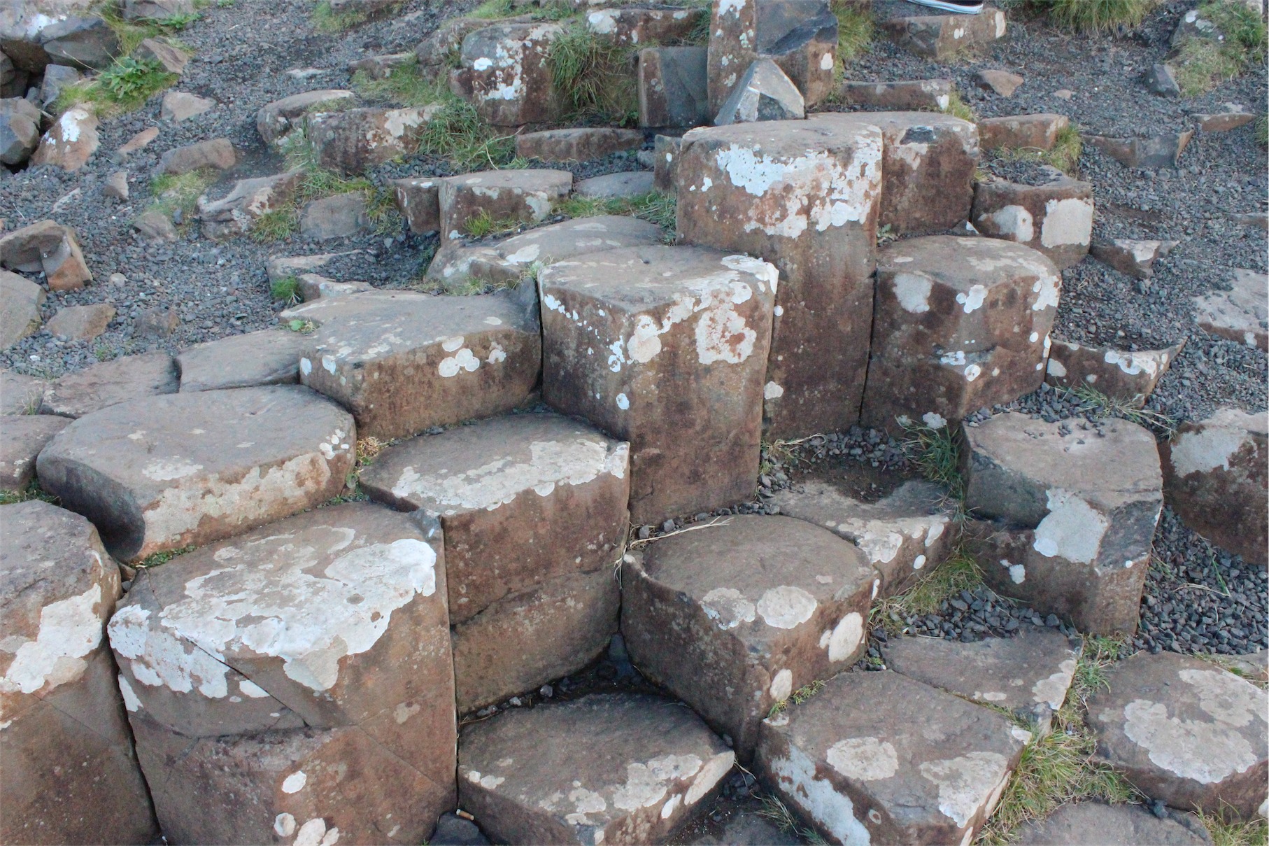
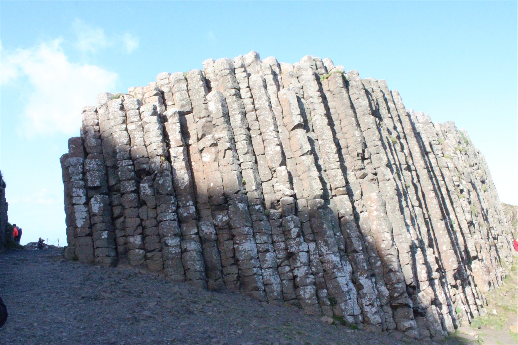
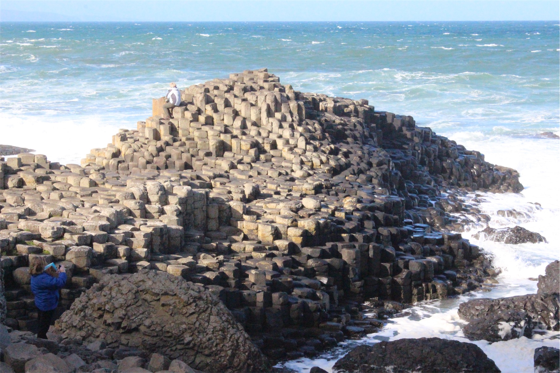
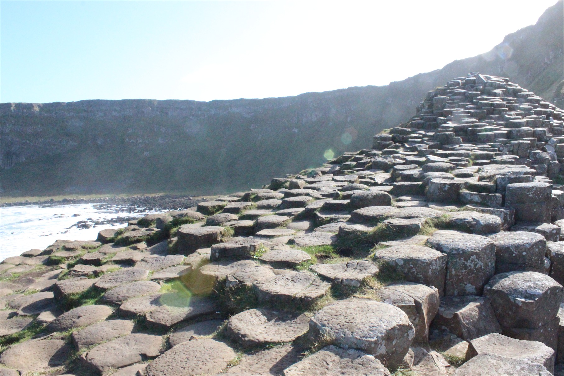
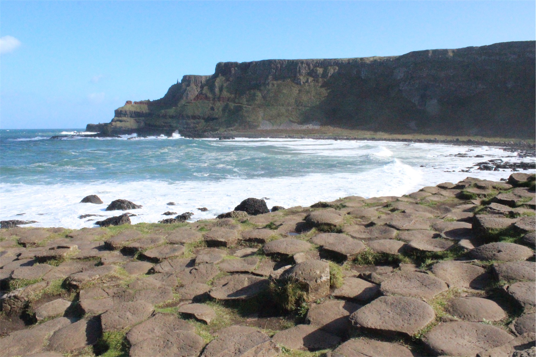
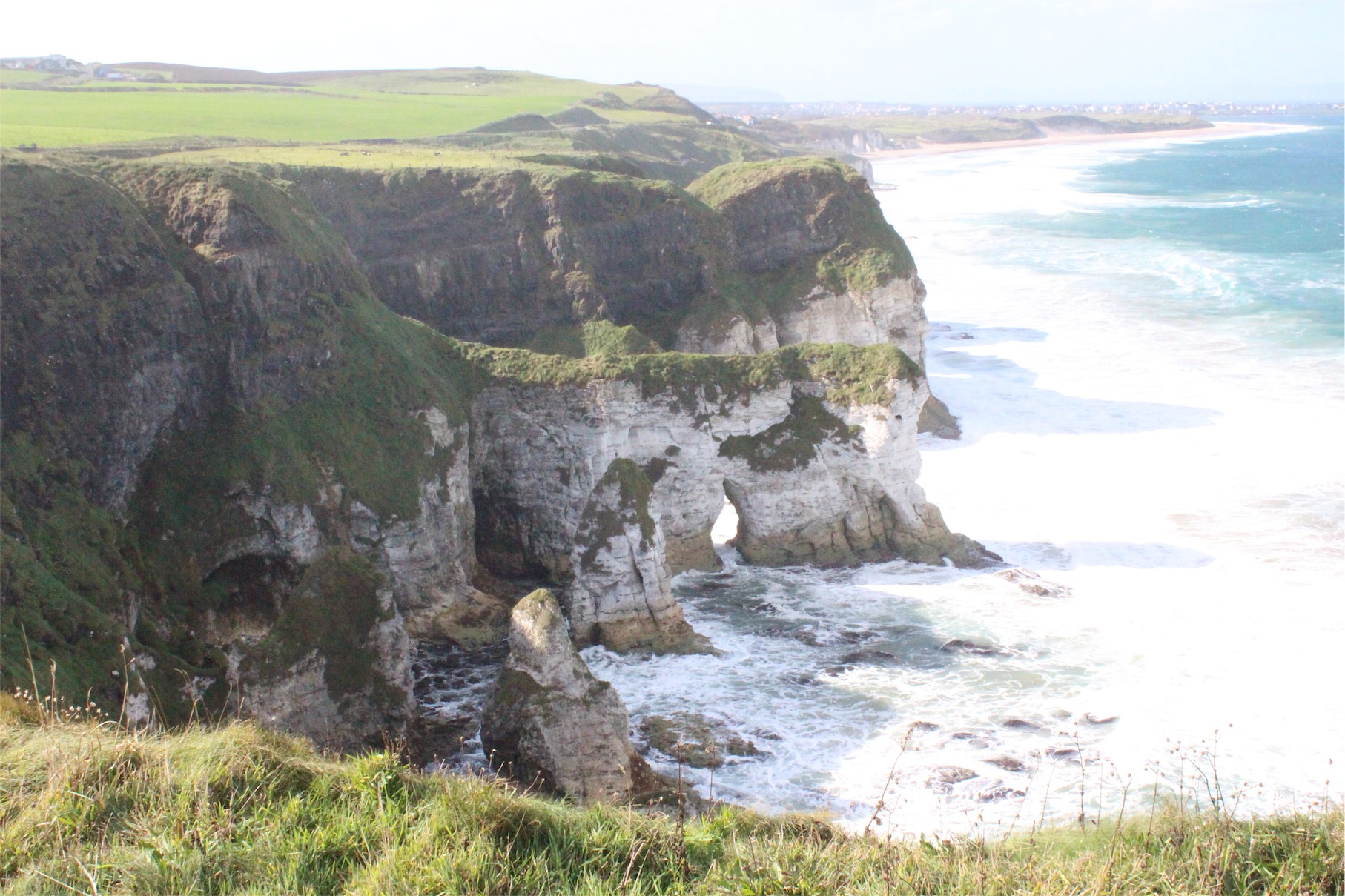
The Giants Causeway is a Unesco listed heritage site that is a result of intense volcanic and geological activity. It is believed that the causeway is a 60 million year old legacy to the cooling and shrinking of successive lava flows. Or it could be that the mighty giant, Finn McCool, wanted to build a way to get to Scotland to have a ‘discussion’ with the giant Benandonner in Scotland who was taunting him.
Regardless of science or legend, the Causeway is mind-blowing and a very unique landscape. The shapes seem alien, nestled in a spectacular coastal setting.

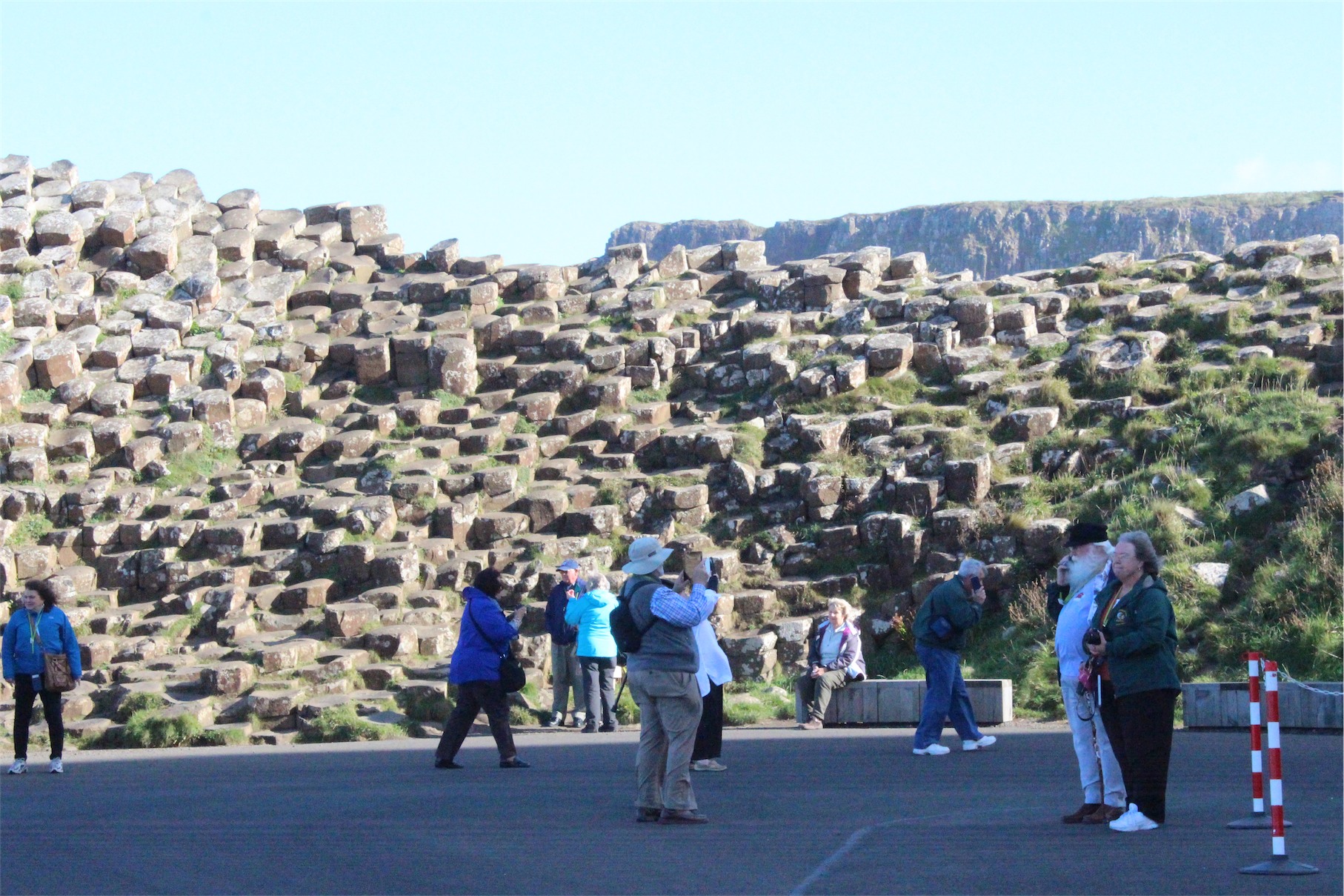


Our experience with the National Trust of UK has been fantastic. Everything was well set out, easy to navigate and well maintained.
For a 9 pound adult entry fee, we could experience the visitors centre (with exhibits and movies), self-guided tour and shuttle bus to the causeway itself. The shuttle bus saves time, but it is a great walk. We enjoyed the walk down and the bus back up the hill.
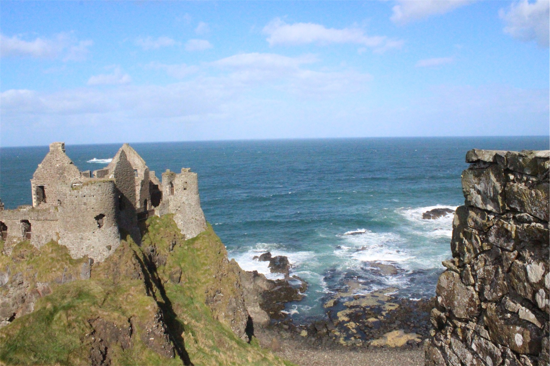
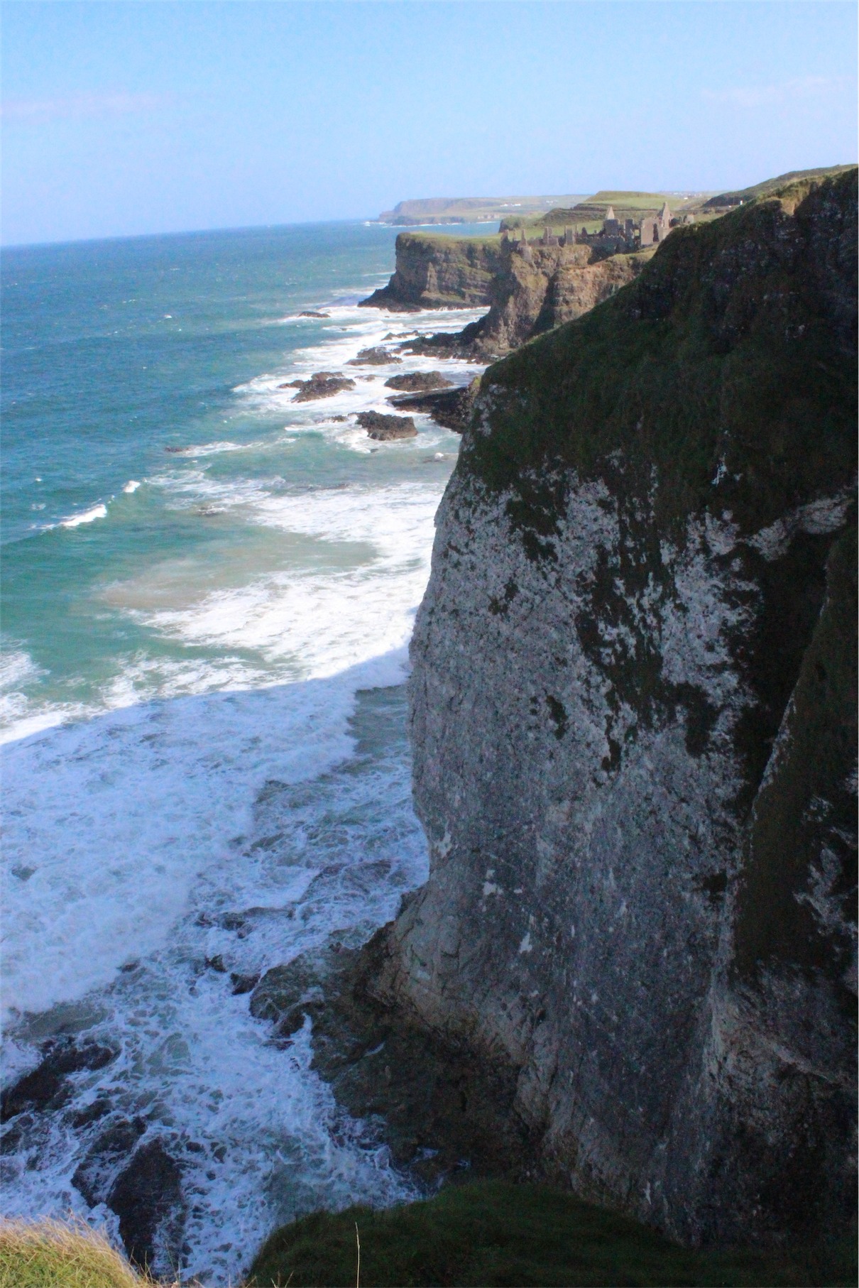
After leaving, we headed west towards Dunluce Castle to see more amazing landscapes. The castle traces back to the 13th century but is now mostly in ruins. It features in Game of Thrones as castle for the House of Greyjoy, though almost unrecognisable due to CGI enhancement.
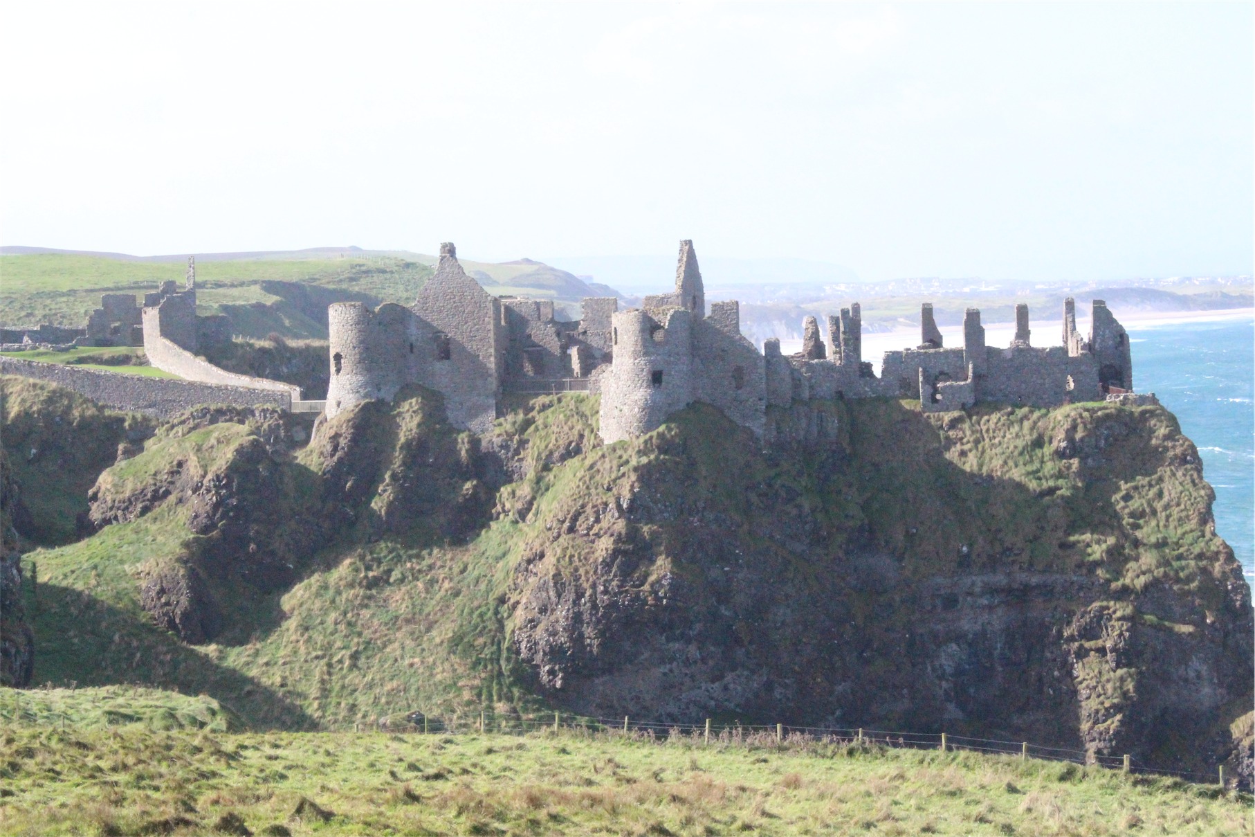

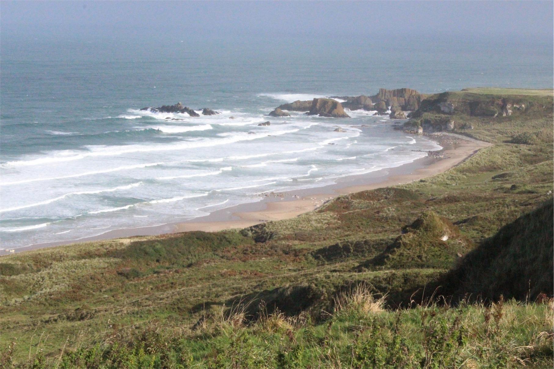
Stretching along the coast from Dunluce Castle are the unique limestone cliffs of the White Rocks. These soft sedimentary rocks have been carved through centuries into a labyrinth of caves and arches.
We found a small car park at a lookout on the coast and decided to have our lunch there. We were pleasantly surprised to find that we were able to get glimpses back towards Dunluce Castle.
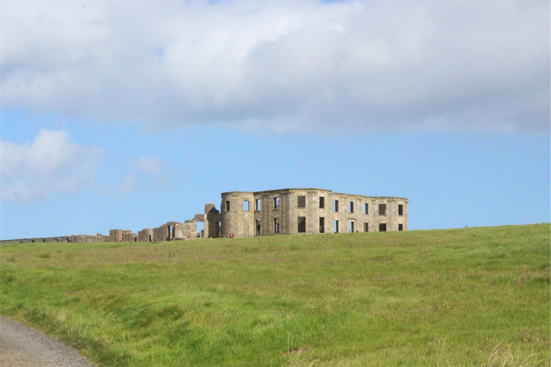
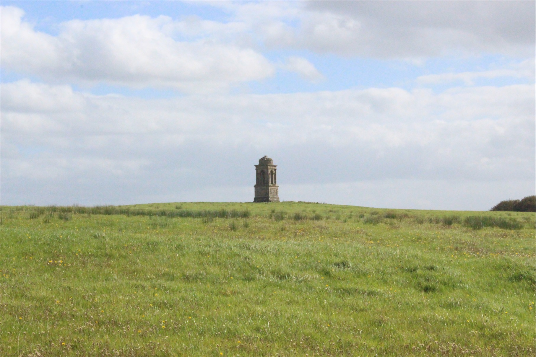
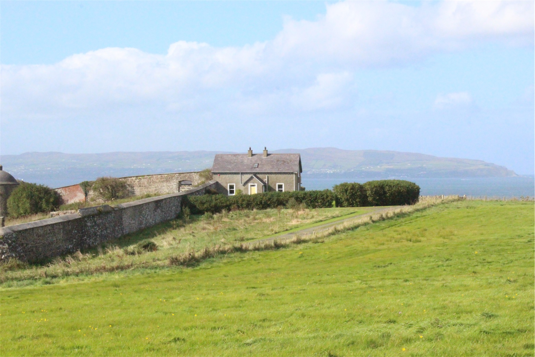
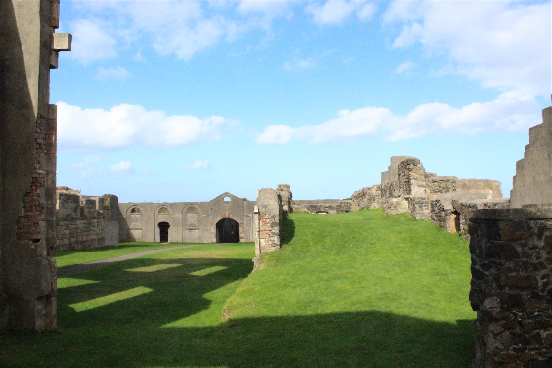
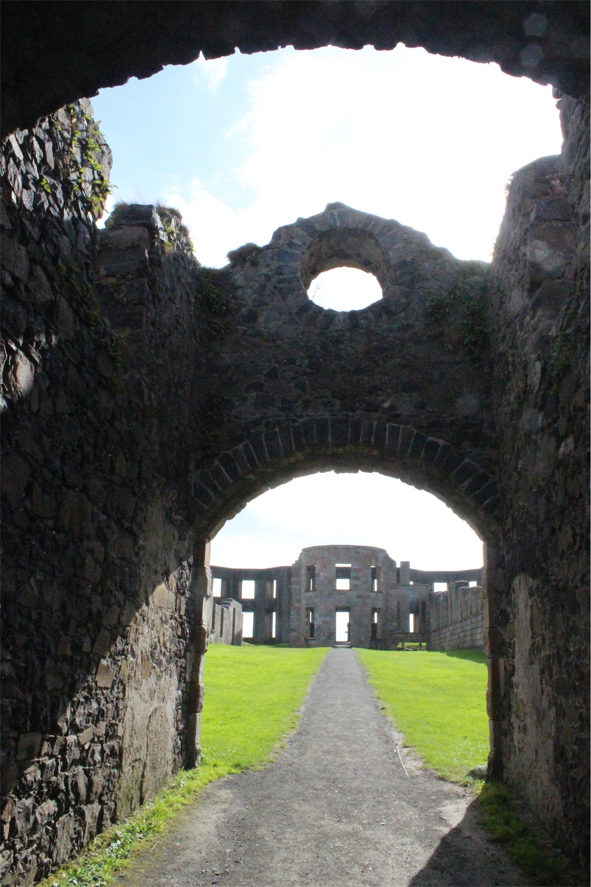
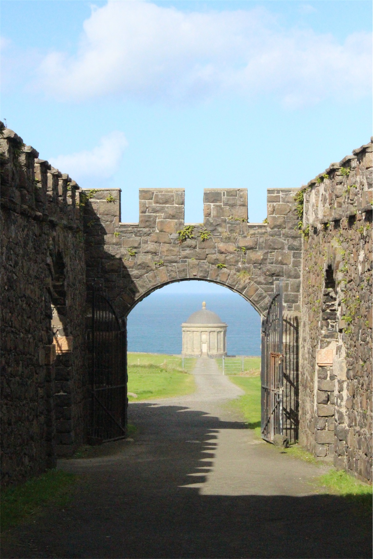
Our next stop on the itinerary was Downhill Demesne, Hezlett House and the Mussenden Temple. They’re all located on an immense grassy field with the house the crowning point and the temple perched on the edge of a 120 foot high cliff. The house was a marvel of design and architecture until destroyed by fire around 1850.
It currently sits a gutted facade, grass as its carpet and sheep living in the servants quarters. The bright green, sky blue and fluffy white clouds made for fantastic photos. Entry was free, the area was well maintained and you could easily roam through the gardens all day.


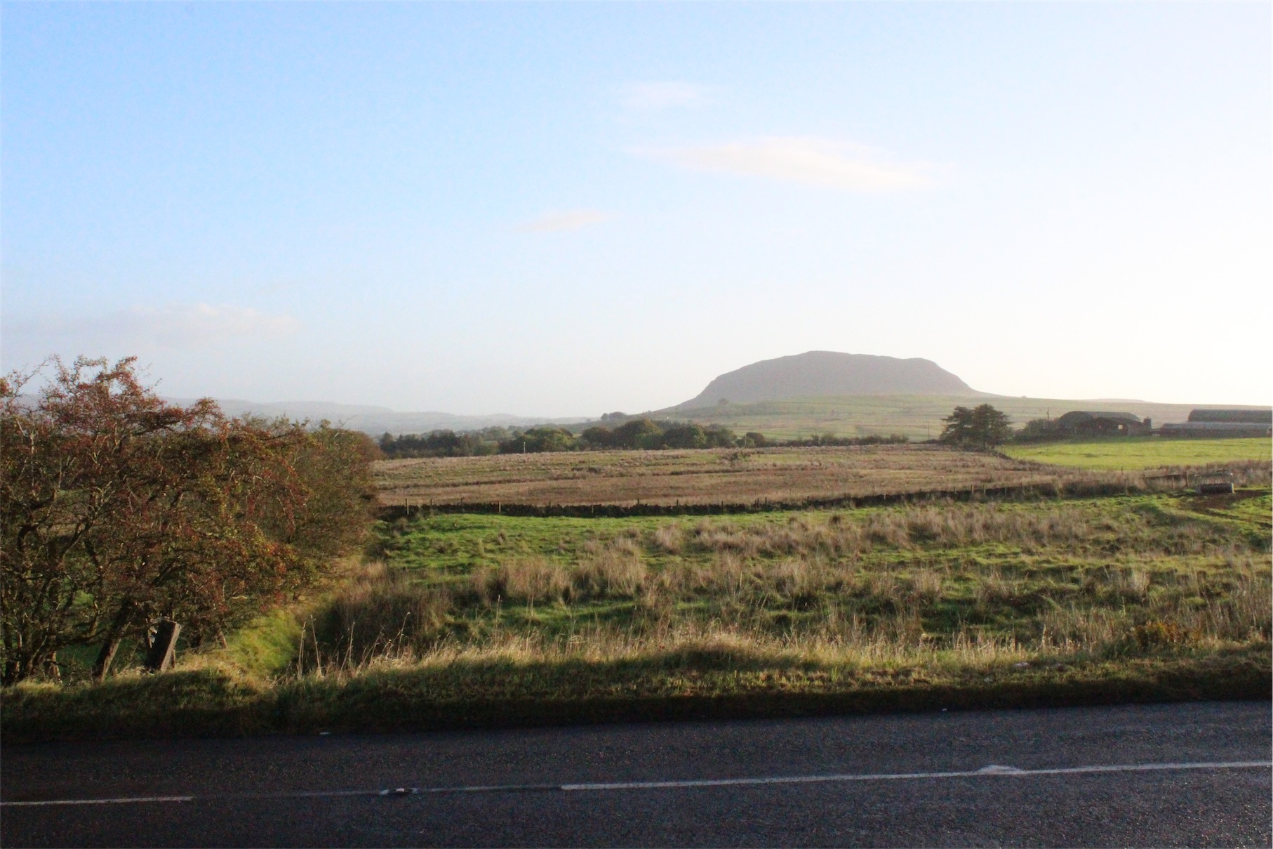
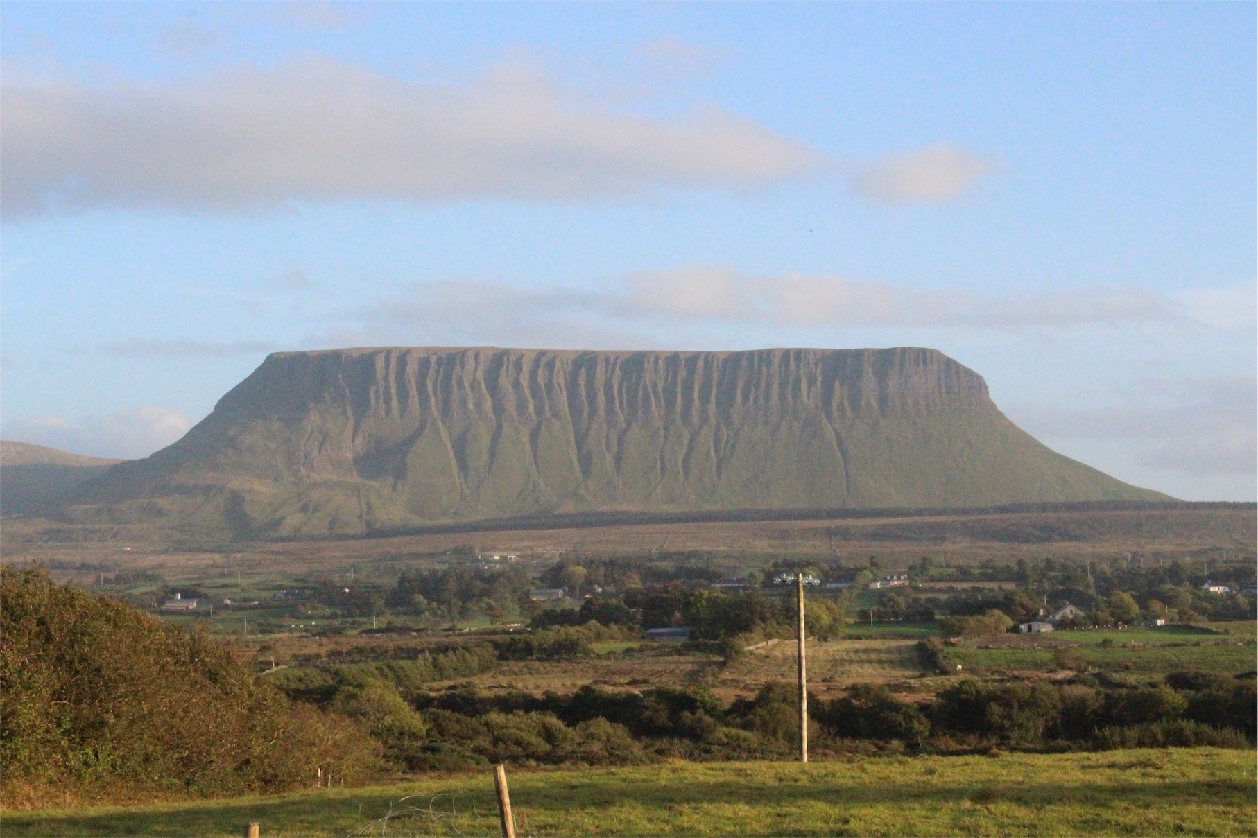
Thirty minutes outside Sligo, our final destination for the night, we spotted Benbulbin. Benbulbin was shaped during the ice age, when Ireland was under glaciers. Originally it was a large plateau. Glaciers moving from the northeast to southwest shaped it into its present distinct formation.
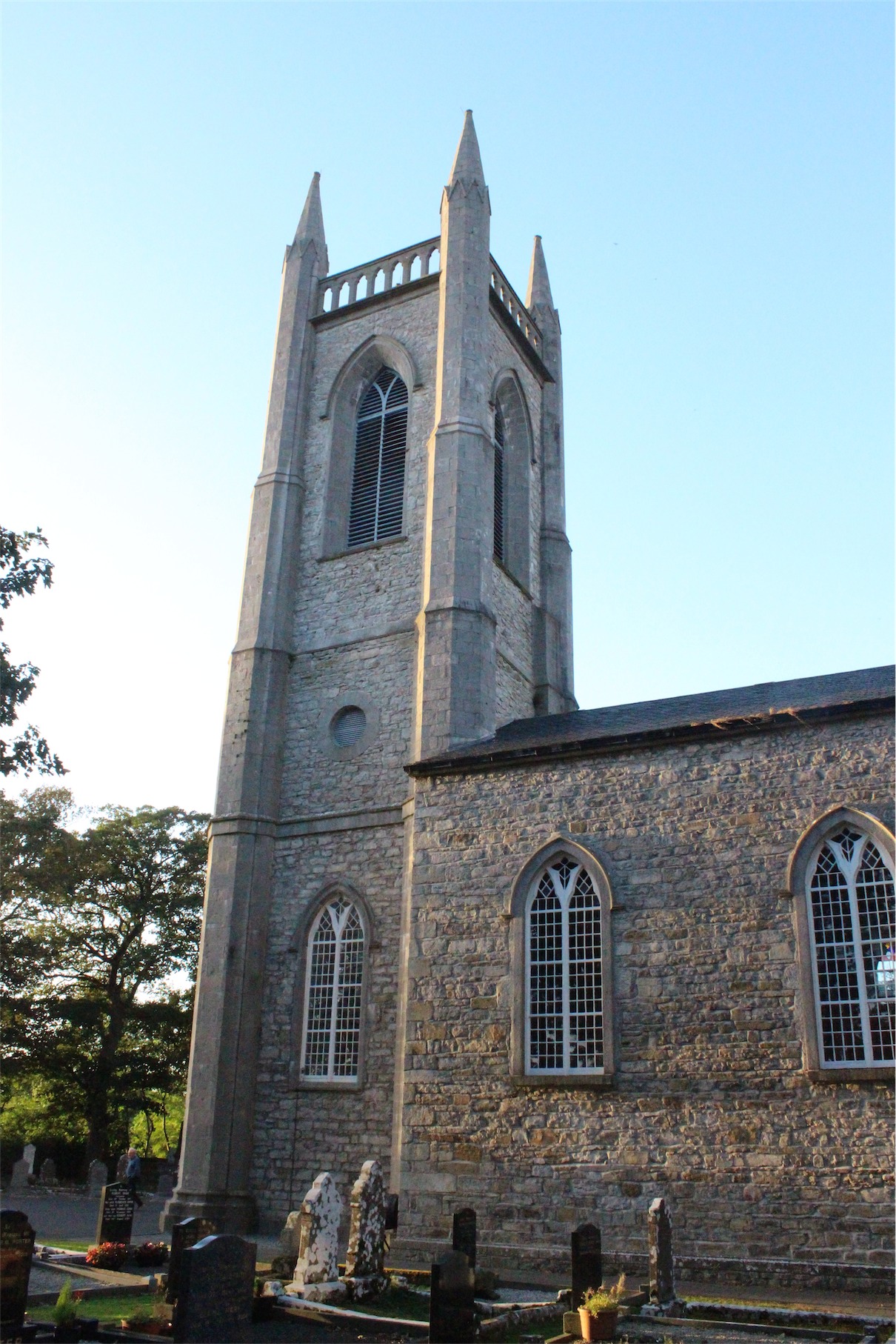
Just before we reached Sligo, we saw St Columba’s Church of Ireland in Drumcliff the location of W.B. Yeats grave.
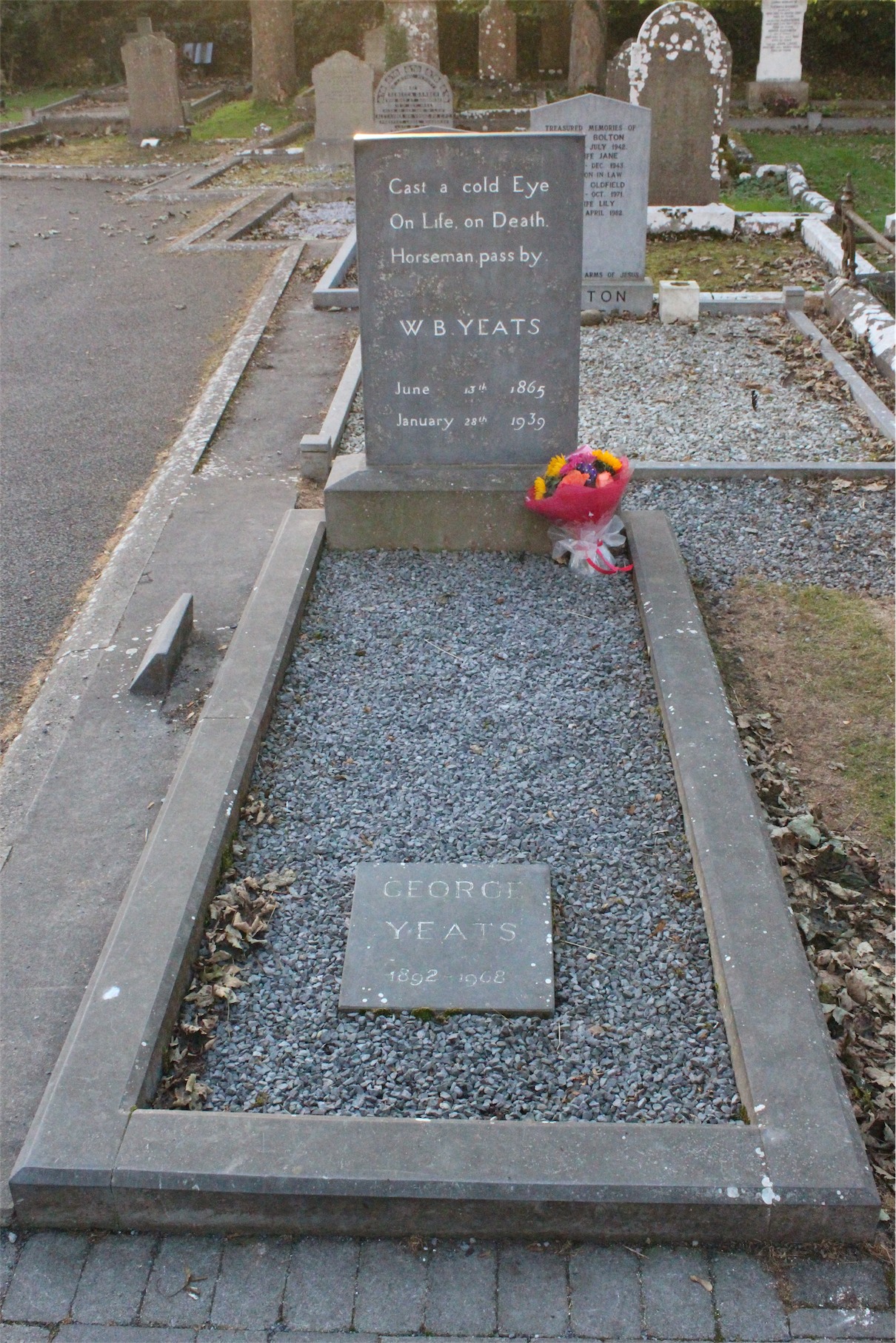
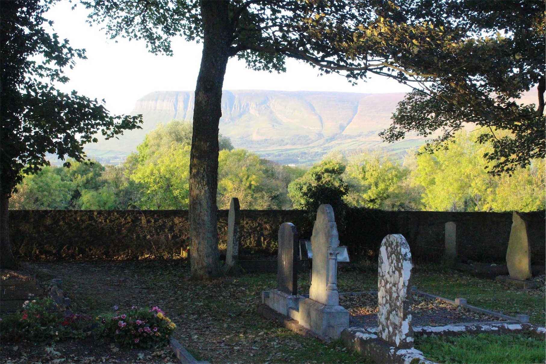
There is still contention regarding the authenticity of Yeats’ remains, initially scattered in an ossuary in France in 1946 before being repatriated by his wife back to Ireland.
Finally we reached Sligo, checked into our hotel and had dinner at the restaurant on site. We retired early, exhausted after a long day with the promise of another huge day of beautiful scenery ahead of us.
